Russia and the United States are often viewed as distant rivals on opposite sides of the globe. However, geography tells a different story. In the frigid waters of the North Pacific, these two countries are separated by a few miles of seawater. Understanding the sea route is essential for anyone interested in global trade, climate science, or international relations.
Which Sea Connects Russia and the USA?
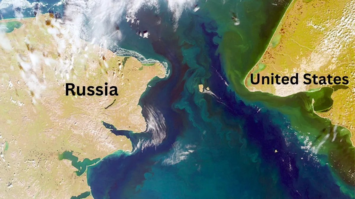
The sea that connects Russia’s Siberian region and the United States Alaska is the Bering Sea which is named after the Danish explorer Vitus Bering. This marginal sea of the Pacific Ocean covers over 2 million square kilometers.
The Bering Sea is bounded to the north by the Arctic Ocean and to the south by the Aleutian Island chain.
Where is the Bering Sea Located?
The Bering Sea is located at the extreme northern end of the Pacific Ocean. The sea sits directly between the Russian Far East, specifically the Chukotka Peninsula and the U.S. State of Alaska region.
How Does It Connect Russia and the USA?
The Bering Sea is the broad body of water and the Bering Strait is the specific narrow passage that links the Bering Sea to the Chukchi Sea, a part of the Arctic Ocean.
-
The Bering Sea: A vast expanse of water used for industrial fishing and transport.
-
The Bering Strait: The physical "choke point" that separates the two continents Asia and North America.
Distance Between Russia and America Across the Bering Sea
The distance between mainland Russia and mainland Alaska is approximately 55 miles (88 km) but the shortest distance between the two countries is actually much smaller between the Big Diomede Island (Russia) and Little Diomede Island (USA) which is mererly 2.4 miles (3.8 km).
Bering Sea Map
The maritime boundary between the two countries, often referred to as the "Baker-Shevardnadze Line," runs through the center of the Bering Sea and the Bering Strait which serves as the International Date Line; when you look across the water from Alaska to Russia, you aren't just looking at another country you are looking at "tomorrow."
-1776597037883.jpg)
Bering Strait
-
The Bering Strait is a narrowest point which is approximately 53 miles (85 km) between Cape Dezhnev, Russia, and Cape Prince of Wales, Alaska.
-
The Diomede Islands sit in the middle of the strait. Big Diomede (Russia) and Little Diomede (USA) are separated by only 2.4 miles.
-
Thousands of years ago, a land bridge known as Beringia existed here, allowing humans to migrate from Asia to the Americas often called as the Ice Bridge.
Important Facts about Bering Sea
Biodiversity: The Bering Sea supports some of the world's largest populations of sockeye salmon, king crab, and walruses.
Global Shipping: As Arctic ice melts, the Bering Strait is becoming a critical passage for the Northern Sea Route.
Climate Research: Scientists monitor this area closely as it is a "canary in the coal mine" for global warming.
| Feature | Detail |
| Max Depth | 13,500 feet (4,115 meters) |
| Primary Port (USA) | Dutch Harbor, Alaska |
| Primary Port (Russia) | Anadyr |
| Border Type | Maritime boundary & International Date Line |
Also Read: Which is the Largest Man Made Lake in Asia?