India is the seventh-largest country by area in South Asia. India is surrounded by the Indian Ocean on the south, the Arabian Sea on the southwest, and the Bay of Bengal on the southeast. Research reveals that modern humans (Homo sapiens) arrived on the Indian subcontinent from Africa no later than 55,000 years ago. These were the early settlers, who were hunter-gatherers.
Since 1950, India has been a federal republic, governed by a democratic parliamentary system. India has a land border of 15,106.7 km and a coastline of 7,516.6 km (including island territories). India shares borders with a total of nine countries, actually; however, two of them are maritime borders. In this article, we will learn the names of the countries that India shares land and maritime borders with.
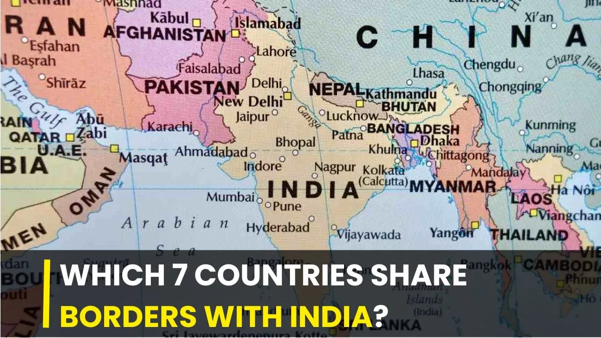
Which 7 countries share borders with India?

India has a land border of 15,106.7 km. India shares land borders with seven countries: Pakistan, China, Nepal, Bhutan, Bangladesh, Myanmar, and Afghanistan. With a coastline of 7,516.6 km (including island territories), India shares maritime borders with two countries: Sri Lanka and the Maldives.
7 Neighbouring Countries That Share Land Border With India
1. Pakistan
India shares a 3,323 km long border with Pakistan, which lies to the northwest of India. Key border crossing include Wagah (Punjab) and Attari (Amritsar). The border is guarded by the Border Security Force (BSF) on the Indian side. The states and union territories sharing border include Rajastha, Gujarat, Punjab, and Jammu & Kashmir.
2. China
India shares a 3,488 km border with China, known as the Line of Actual Control (LAC). It is the second-longest border for India. China lies to the north and northeast of India. The border primarily separates the Indian states/UTs (Ladakh, Himachal Pradesh, Uttarakhand, Sikkim, Arunachal Pradesh) from the Tibet Autonomous Region of China.
3. Nepal
With a 1,751 km (upto 1,850 km in some reports) long border, Nepal lies to the north of India. Indian states that share border Nepal include Uttarakhand, Uttar Pradesh, Bihar, West Bengal, and Sikkim. The Sashastra Seema Bal (SSB) is responsible for guarding the border.
4. Bhutan
India shares a 699 km border with Bhutan, which lies to the northeast of India. The boundary touchesfour Indian states, namely Sikkim, West Bengal, Assam, and Arunachal Pradesh. The boundary was officially recognized through the Treaty of Sinchula on 11 November 1865.
5. Bangladesh
India and Bangladesh share a 4,097 km long international border, which is India's longest lang border and the fifth-longest in the world. Five Indian states touch boundary with Bangladesh including West Bengal, Assam, Meghalaya, Tripura, and Mizoram. Of these, West Bengal shares the longest border with Bangladesh at 2,217 km.
6. Myanmar
India shares a 1,643 km long border with Myanmar, which runs along four northeastern Indian states namely Arunachal Pradesh, Nagaland, Manipur, and Mizoram. This border acts as a gateway to Southeast Asia. The Indo-Myanmar border separates India from Myanmar's Kachin State, Sagaing Region, and Chin State.
7. Afghanistan
India and Afghanistan share a 106 km border, which is located in the Wakhan Corridor of the Union Territory of Ladakh. However, this region lies currently in Pakistan-occupied Kashmir (PoK). India-Afghanistan border is the shortest land border among India's neighbouring countries.
Also read: Which Countries are Separated by the Durand Line?