
A tropical cyclone is a low-pressure system forming over warm ocean waters near the equator. These massive storms bring strong winds, heavy rainfall, and storm surges. Recently, a powerful storm, Cyclone Montha, has formed over the Bay of Bengal, which is expected to hit India's east coast soon, bringing heavy rain and strong winds. It formed over the southeast Bay of Bengal in late October 2025 and is moving toward the Andhra Pradesh coast, where it may make landfall near Kakinada.
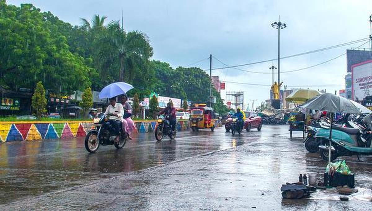
The storm is likely to become a severe cyclonic storm. It will affect parts of Andhra Pradesh, Odisha, and Tamil Nadu. These areas are at high risk of flooding, strong winds, and damage to homes and crops. The name "Montha" was given by Thailand. It means a fragrant flower. Countries in the region name cyclones in the Indian Ocean once wind speeds reach 62 km/h. In this article, we'll take a look at how Cyclone Montha formed, what its name means, which areas are most vulnerable, and how people are preparing for its impact.
What is Cyclone 'Montha'? Check Its Formation, Vulnerable Zones, and Meaning of the Name
Cyclone 'Montha' is a powerful tropical storm that formed as a low-pressure system over the Bay of Bengal. This is one of the most common zones for such storms in the North Indian Ocean. The system rapidly intensified from a deep depression into a cyclonic storm. The storm is currently moving towards the eastern coast of India.
It is approaching the coast of Andhra Pradesh and is likely to make landfall near Kakinada between Machilipatnam and Kalingapatnam. This landfall is expected on the evening or night of Tuesday, October 28, as a Severe Cyclonic Storm.
Formation
Cyclone 'Montha' formed over the Bay of Bengal, a significant breeding ground for tropical cyclones. It began as a low-pressure area, then strengthened into a deep depression, and finally intensified into a cyclonic storm. It is currently strengthening and is expected to become a Severe Cyclonic Storm before landfall. Cyclones form when warm, moist air rises over the ocean, creating a low-pressure area that draws in surrounding air. This process, fuelled by warm sea surface temperatures, leads to the massive rotation of a storm system.
Approaching Path and Landfall
The storm is currently tracking towards the eastern coast of India. Cyclone 'Montha' is approaching the coast of Andhra Pradesh. Its landfall is expected near Kakinada, between Machilipatnam and Kalingapatnam. This is scheduled on the evening or night of Tuesday, October 28, 2025. At the time of landfall, it is forecast to have maximum sustained wind speeds of 90-100 km/h, gusting up to 110 km/h.
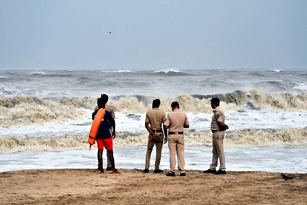
Vulnerable Zones and Alert Status

The primary vulnerable zones are the coastal and adjoining districts of Andhra Pradesh and Odisha. These regions are on high alert. The India Meteorological Department (IMD) has issued Red and Orange Alerts for many districts, warning of impending heavy to extremely heavy rainfall and strong winds.
Disaster response teams (NDRF/SDRF) have been deployed, and evacuations are underway in low-lying coastal areas to ensure zero loss of life. Parts of Tamil Nadu and West Bengal are also preparing for heavy rain and gusty winds.
Naming and Meaning
The name 'Montha' was contributed by Thailand. According to the standard naming convention for cyclones in this region, the name 'Montha' translates to a "fragrant flower" or a "beautiful flower" in the Thai language. This name, selected from a pre-approved list, helps the public and disaster management agencies clearly identify and track the specific storm.
Key Impact Forecast
The most significant impact is expected to be:
- Heavy to Extremely Heavy Rainfall, which can cause flash floods and inundation.
- Gale-force Winds that can damage power lines, communication infrastructure, and houses.
- Storm Surge (rising seawater) along the low-lying coastal districts during the time of landfall.
- Disruption to fishing activity and coastal shipping.
Which Areas Are at Risk Due to Cyclone 'Montha'?

The primary risk from Cyclone 'Montha' is concentrated along the east coast of India, particularly in Andhra Pradesh and Odisha, due to the forecasted path and potential for heavy to extremely heavy rainfall, strong winds, and storm surge.
Andhra Pradesh (Landfall Zone)
Andhra Pradesh is the most vulnerable state, as the cyclone is expected to make landfall near Kakinada (between Machilipatnam and Kalingapatnam). The coastal and adjoining districts are on Red Alert for extreme weather conditions.
Highly Affected Districts (Coastal & Adjoining):
- Kakinada (Near the expected landfall point)
- East Godavari
- Konaseema
- West Godavari
- Krishna
- Eluru
- Bapatla
- Prakasam
- Nellore
- Visakhapatnam and Anakapalli (also expected to be significantly impacted)
- Odisha (Peripheral Impact)
While the cyclone is not expected to make landfall in Odisha, its southern and interior districts are in the path of heavy rainfall and strong winds, posing a high risk of flooding and landslides.
High Alert/Red Zone Districts (Southern & Interior):
- Malkangiri
- Koraput
- Rayagada
- Nabarangpur
- Gajapati
- Ganjam
- Kandhamal
- Kalahandi
Other Affected States
Heavy to very heavy rainfall, strong winds, and squally weather are also forecast for other states, warranting Orange and Yellow alerts.
- Telangana: Red/Orange alerts for heavy rainfall in districts like Jayashankar Bhupalpally, Mulugu, Bhadradri Kothagudem, and Mahabubabad.
- Tamil Nadu: Coastal districts, including Chennai, Tiruvallur, Kanchipuram, and Ranipet, are on Orange Alert for heavy to very heavy rainfall.
- Puducherry (Yanam): Expected to receive extremely heavy rainfall.
- West Bengal: Southern districts (including North and South 24 Parganas, Purba and Paschim Medinipur, and Howrah) and parts of North Bengal are likely to receive heavy rainfall and gusty winds.
- Chhattisgarh: Expected to receive heavy to extremely heavy rainfall due to the system's movement after landfall.


Comments
All Comments (0)
Join the conversation