National Weather Service Issues Severe Thunderstorm Watch for Millions Across Central Plains
The Storm Prediction Center has issued a widespread severe thunderstorm watch across the central and northern Plains. Atmospheric instabilities threaten to bring destructive 80 mph wind gusts, baseball-sized hail, and isolated tornadoes, prompting emergency officials to advise immediate readiness.
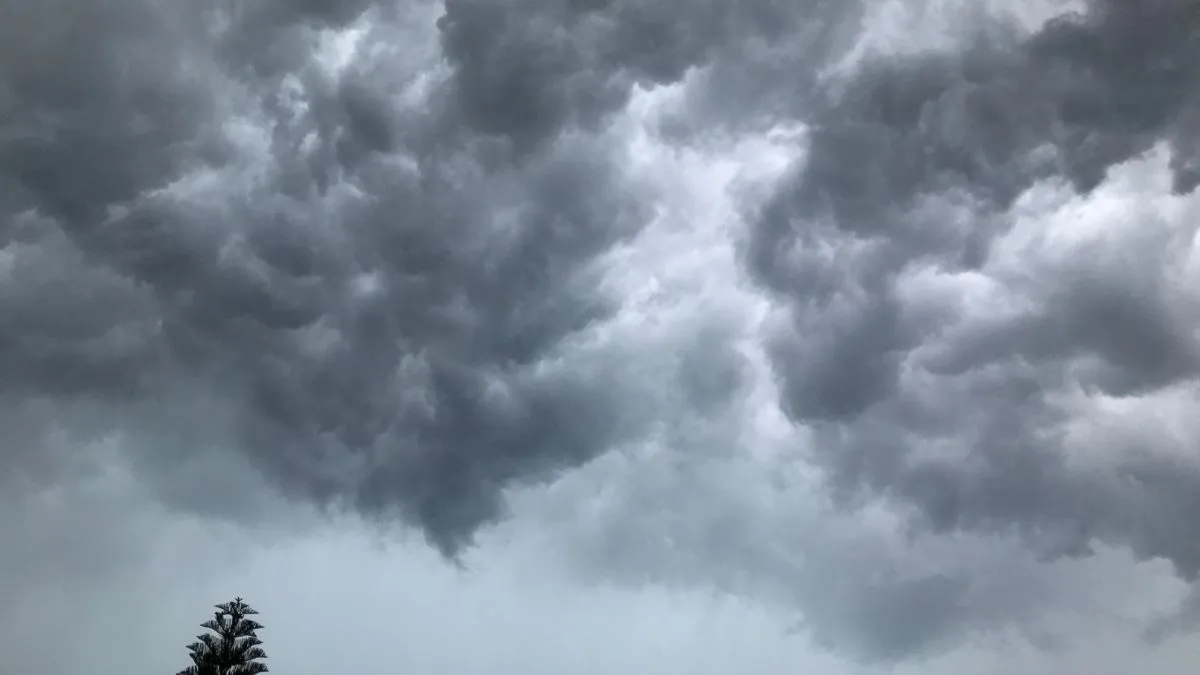
The National Weather Service (NWS) and the Storm Prediction Center (SPC) issued a broad severe thunderstorm watch across the central United States, placing millions of residents on high alert. Meteorological models show a powerful low-pressure system colliding with an unseasonably warm, moisture-rich air mass from the Gulf of Mexico.
This environment has increased threat levels across much of the region to an Enhanced Risk (Level 3 of 5) in official NOAA convective outlooks. As volatile supercells ignite, local emergency management divisions are encouraging the public to monitor live weather radar and prepare for quick upgrades to a severe thunderstorm warning.
What is the Difference Between a Severe Thunderstorm Watch and a Warning?
Knowing the NWS alerting terminology is very important so you can take the appropriate action to protect yourself when the atmosphere is active. While both alerts should be taken seriously, they are in completely different realms of immediate risk and atmospheric verification.
-
Severe Thunderstorm Watch: This indicates that regional atmospheric conditions are highly favorable for the development of organized severe weather. A watch is typically issued by the SPC in Norman, Oklahoma, covers multiple counties or states, and remains active for six to nine hours. It serves as a defensive "heads-up" to review safety plans.
-
Severe Thunderstorm Warning: This is a localized, high-urgency alert issued by your community's NWS forecast office. It signifies that a severe storm is officially occurring or has been indicated on Doppler radar. Action must be taken immediately to protect life and property, as warnings generally cover small geographic boundaries and last under an hour.
| Alert Parameter | Severe Thunderstorm Watch | Severe Thunderstorm Warning |
| Issuing Authority | Storm Prediction Center (SPC) | Local National Weather Service Office |
| Primary Meaning | Conditions are favorable; Be Prepared | Severe weather is imminent; Take Action |
| Typical Duration | 6 to 9 Hours | 30 to 60 Minutes |
| Spatial Coverage | Broad (Multiple Counties/States) | Small (Specific Cities/Storm Paths) |
What are the Safety Measures for a Severe Thunderstorm Watch?
When meteorologists place your area under a watch, defensive preparation should begin immediately before cloud formations darken. Ensure your household is ready to transition into shelter at a moment's notice.
-
Charge Crucial Electronic Devices: Power outages are highly common when lines are exposed to severe atmospheric winds. Charge mobile devices, backup battery banks, and laptops early.
-
Secure Outdoor Property: Intense atmospheric updrafts and straight-line winds can transform loose yard debris into lethal projectiles. Move patio furniture, trash receptacles, and loose tools inside your garage.
-
Establish Multiple Communication Channels: Do not rely on a single medium for emergency warnings. Keep a NOAA All Hazards Weather Radio active, enable Wireless Emergency Alerts (WEA) on your smartphone, and monitor local television broadcasts.
-
Identify an Interior Safe Room: Map out a structural shelter zone ahead of time. This should be an interior room on the lowest floor of a building, such as a basement, storm cellar, or a central closet, away from exterior windows and doors.
Can a Severe Thunderstorm Watch Upgrade into a Tornado Watch?
Atmospheric dynamics are highly fluid, meaning a severe thunderstorm watch can evolve into a tornado watch if directional wind shear increases rapidly in the lower atmosphere. Supercell thunderstorms responsible for generating significant hail and destructive straight-line winds possess rotating updrafts.
If these rotating columns tighten and tilt toward the earth's surface due to changing low-level winds, tornado development becomes a primary threat. Meteorologists constantly analyze real-time thermodynamic data to modify active watches, often incorporating "Particularly Dangerous Situation" (PDS) tags if a widespread convective wind or tornado outbreak becomes imminent.
Your best defense is to stay informed through verified meteorological channels if the volatile weather conditions over the central Plains get worse. Keep your smartphone alerts on, watch for changes on local radar, and proceed with extreme caution in any changing weather pattern until the National Weather Service officially says the regional watch has expired.

Harshita Singh is an education and general knowledge journalist with over 5 years of experience in educational writing. Specializing in US affairs and GK, Harshita has a track record of breaking down intricate geopolitical and historical subjects into clear, digestible insights for learners. Her strong background in text analysis, coupled with a Bachelor of Arts (Hons) in English from the University of Delhi, helps her produce authoritative, thoroughly researched content that empowers readers to engage confidently with global current affairs. For inquiries or academic insights, you can reach out to her directly at harshita.singh@jagrannewmedia.com.


