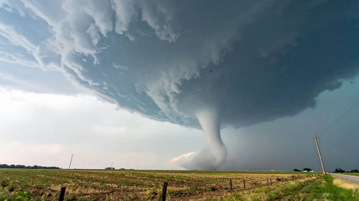
A volatile atmospheric setup has triggered a tornado watch across Central Florida, placing millions of residents and tourists on high alert this Saturday, May 2, 2026. The National Weather Service (NWS) Storm Prediction Center issued Watch Number 183 at 11:25 AM, effective until 6:00 PM EDT, covering a broad region from Tampa Bay to the Space Coast.
Primary threats include isolated tornadoes and damaging wind gusts reaching up to 65 mph. Meteorologists are monitoring a line of intense storms moving inland across the north-central Peninsula, which could gain strength as it interacts with high afternoon temperatures. Officials urge everyone in the affected areas, particularly those at outdoor theme parks like Walt Disney World, to remain weather-aware as conditions can deteriorate rapidly.
Which Florida Counties are Under the Tornado Watch?
The current tornado watch encompasses a significant portion of the Florida Peninsula. According to the NWS, the following areas are under heightened surveillance:
-
Central Florida: Orange (Orlando), Osceola (Kissimmee), Seminole, Lake, and Volusia counties.
-
West Central and Tampa Bay: Polk, Sumter, Citrus, Hernando, Hillsborough, Pasco, and Pinellas.
-
Coastal Regions: Locations ranging from 55 miles north-northwest of St. Petersburg to 25 miles southeast of Daytona Beach.
This alert indicates that atmospheric conditions are conducive to tornado development. While a tornado is not currently on the ground, the risk is high enough that emergency plans should be reviewed immediately.
Tornado Watch vs Warning: What’s the Difference?
In a severe weather event, timing is everything. Knowing the distinction between these two NWS alerts can save lives:
| Alert Type | Meaning | Action Required |
| Tornado Watch | Be Prepared. Conditions are favorable for tornadoes to form. | Review your safety plan and keep your phone charged. |
| Tornado Warning | Take Action. A tornado has been sighted or indicated by radar. | Move to an interior room or basement immediately. |
Check Out: What are the Snowiest Cities in the United States?
Essential Safety Tips for Central Florida Residents
With wind gusts of 65 mph and coin-size hail possible, the NWS Melbourne and Tampa offices recommend the following precautions:
-
Monitor Live Radar: Keep a NOAA Weather Radio or a reliable weather app active to receive real-time updates.
-
Identify Your Safe Room: The best place to be is an interior room on the lowest floor of a sturdy building, away from windows.
-
Avoid Outdoor Risks: If you are at a theme park or camping, follow all instructions from staff members. Outdoor attractions at Disney World and Universal Orlando may close temporarily.
-
Secure Loose Items: High winds can turn patio furniture and trash cans into dangerous projectiles.
Also Read - India Dominates Global Heat Charts with 98 of 100 Hottest Cities Recorded Worldwide
What to Expect as the Storm Front Moves Inland
The Storm Prediction Center notes that damaging winds will be the most common risk as the line of storms pushes through the Peninsula. However, the presence of low-level rotation means a couple of tornadoes are possible.
Temperatures today have reached the mid-90s in some interior areas, providing the energy needed for these storms to turn severe. As the front pushes toward the Atlantic coast this evening, heavy rainfall may also lead to localized flooding in low-lying areas.
Check Out - Which are the Top 7 Snowiest Places on Earth?
As this weather system evolves, staying informed is your best defense. The National Weather Service will continue to provide updates as the line of storms progresses. Ensure your Wireless Emergency Alerts (WEA) are enabled on your mobile devices to receive life-saving notifications if a tornado warning is issued for your specific location later today.


