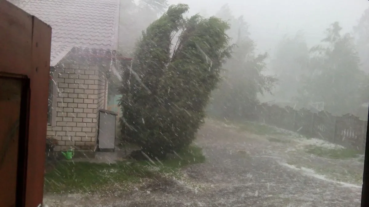
A severe weather outbreak with multiple phases is currently hitting the middle of the country. Hailstorms and strong winds are hitting a corridor that runs from the Texas-Mexico border to the Great Lakes. The NOAA Storm Prediction Center (SPC) has put out an Enhanced Risk (Level 3/5) for some areas of the Upper Mississippi Valley and the Southern Plains as of Friday, April 17, 2026.
Forecasters are warning of giant hail, some of which is more than two inches wide, which is very dangerous for cars and roofs. With over 51 million Americans in the path of these rotating supercells, emergency management agencies are on high alert as the atmospheric setup mirrors some of the most volatile spring patterns seen in recent years.
Where are the most dangerous hailstorms today?
The current meteorological setup features a powerful upper-level trough clashing with warm, buoyant air surging from the Gulf of Mexico. This has created a triple threat of giant hail, tornadoes, and flash flooding.
Primary Zones at Risk:
-
Southern Plains: Oklahoma and North Texas are seeing the highest probability of very large hail capable of shattering windshields.
-
Upper Mississippi Valley: Iowa, Wisconsin, and Northern Illinois are bracing for supercells that may also produce strong tornadoes.
-
Midwest: Missouri and Kansas remain under a Slight Risk as storms grow "upscale" into the evening hours.
Also Read - Wisconsin Flood Warning Triggers Major Highway Closures and Emergency Rescues in Milwaukee
How much damage can these hail storms cause?
According to recent insurance industry data from the Insurance Information Institute, severe convective storms, including hail and straight-line winds, have caused over $50 billion in insured losses for three consecutive years. Today's event is expected to add significantly to those figures.
| Feature | Predicted Intensity | Potential Impact |
| Hail Size | 2.0" - 4.0" (Egg to Grapefruit) | Roof destruction, vehicle totals |
| Wind Gusts | 60 - 75 MPH | Power outages, downed trees |
| Flash Flooding | 1" - 2" per hour | Street flooding, creek overflows |
Large hail hit parts of Northeast Ohio, including Cleveland, on Wednesday, pelting flooded roads and smashing car windows. pic.twitter.com/0LZRZXzypK
— AccuWeather (@accuweather) April 16, 2026
Official Safety Guidelines from the National Weather Service
The National Weather Service (NWS) urges residents in the affected regions to "remain weather aware" and have multiple ways to receive alerts.
-
Seek Shelter: If a warning is issued, move to an interior room on the lowest floor.
-
Protect Property: If safe, move vehicles into garages or under carports before storms arrive.
-
Avoid Travel: "Please do not drive through flooded roadways," warns the City of Madison Engineering Division, citing saturated ground from previous rain.
Check Out - Northern Lights Forecast: 20 States Under G2 Storm Watch For Stunning Aurora Friday Night
As this volatile system moves eastward, the threat of hail storms remains a primary concern for homeowners and insurers alike. With the storm front expected to reach the Ohio Valley by Saturday, residents should continue monitoring local radar and official NWS updates to ensure personal safety during this significant spring weather event.


