Show Key Points
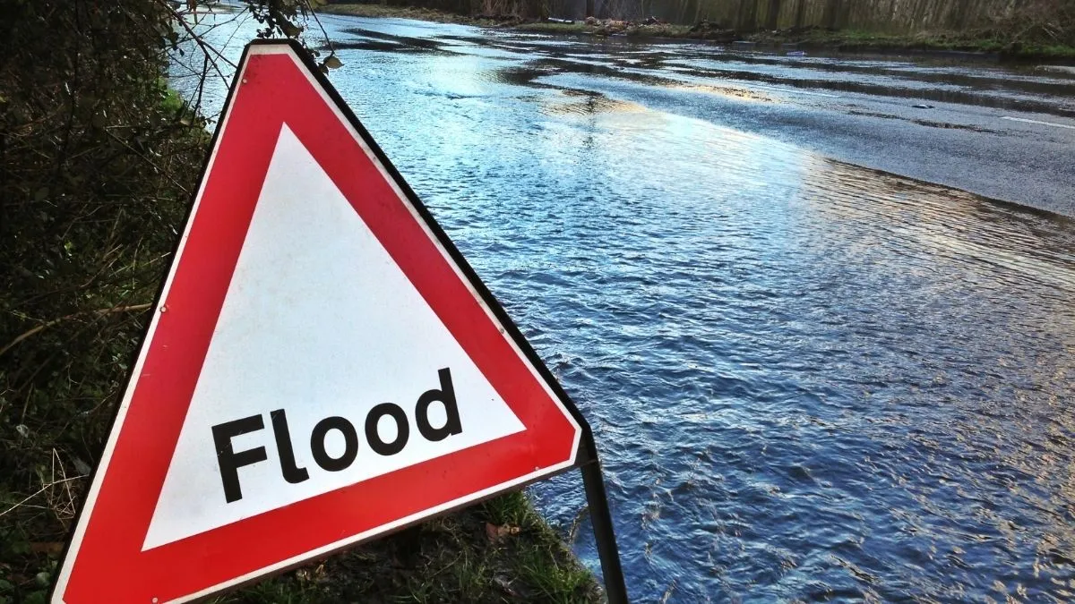
The National Weather Service (NWS) has extended a major flood warning for Milwaukee and the counties around it until April 17, 2026. This is because a storm system is still pounding the Midwest. After record-breaking rain that fell more than four inches in less than six hours, Wisconsin Governor Tony Evers officially declared a State of Emergency to make it easier to help people in need.
The crisis reached a breaking point Wednesday evening when flash flooding transformed major thoroughfares into rivers, trapping motorists and prompting the Milwaukee County Sheriff’s Office to issue a dire stay off the roads mandate. With the Wisconsin River at Portage projected to crest at 20.3 feet, its highest level since 2010, emergency crews are now shifting focus from active rescues to critical infrastructure protection.
Which Wisconsin Highways are Currently Closed?
The Wisconsin Department of Transportation (WisDOT) and local law enforcement have shuttered several high-traffic corridors due to standing water and structural concerns. Motorists are urged to consult the 511 Wisconsin system before attempting any travel.
| Highway / Route | Location / Impact | Status |
| I-43 Southbound | Mitchell Interchange | Closed |
| Brewers Boulevard | Northbound & Southbound (Stadium) | Closed |
| Levee Road | Hwy 33 West to Sauk County Line | Closed Indefinitely |
| Local Arterials | 30th Street Industrial Corridor | Partial Blockage |
Official reports from the Milwaukee County Sheriff's Office confirmed that multiple vehicles were submerged near the Mitchell Interchange, necessitating boat-assisted rescues. WisDOT warns that even if water appears shallow, roadbeds may be washed out beneath it, making driving through any flooded area a life-threatening risk.
Also Read - These are the 9 Busiest Airports in the US - No. 7 will Surprise You
Is the Wisconsin River Expected to Reach Record Levels?
According to the latest hydrological data from NOAA and the Wisconsin DNR, the situation in Portage is escalating toward a major flood stage.
-
Current Level: 18.90 feet (as of Thursday morning).
-
Projected Crest: 20.3 feet by the upcoming weekend.
-
Flood Stage: 17.0 feet.
The DNR has initiated 24-hour surveillance of the Caledonia and Lewiston levees. Residents in low-lying areas, particularly Blackhawk Park, have been advised by Columbia County Emergency Management to relocate to higher ground immediately. Sandbagging stations have been established at the Columbia County Highway Shop in Wyocena to assist homeowners in mitigating property damage.
Also Read - From Lituya Bay to Alaska: The 5 Largest Tsunamis to Ever Hit American Shores
How to Respond to an Active Flood Warning?
The NWS Milwaukee/Sullivan office reiterates the Turn Around, Don't Drown campaign, noting that 60% of flood-related fatalities occur in vehicles.
-
Avoid Standing Water: Just six inches of fast-moving water can knock over an adult; twelve inches can carry away a small car.
-
Heed Barriers: Road closures are enforced for structural safety. Bypassing barriers can lead to criminal charges and dangerous entrapment.
-
Monitor Alerts: Keep a battery-powered weather radio active, as ReadyWisconsin has canceled annual tornado drills to keep emergency frequencies clear for real-world flood responses.
Check Out - Northern Lights Forecast: 20 States Under G2 Storm Watch For Stunning Aurora Friday Night
As Wisconsin grapples with this evolving hydrological crisis, the priority remains public safety and infrastructure integrity. With more rain in the forecast, the flood warning is likely to persist through the weekend. Stay tuned to official WisDOT and NWS channels for real-time updates on road openings and river crest levels across the state.


-1776338973031_t.webp)
