Hurricane season of 2025 is underway, and Tropical Storm Erin has formed in the Atlantic and has become one of the more followed storms of the season. Erin formed just west of the Cabo Verde Islands, has maximum sustained winds of about 45 mi/hr, and is moving westward at a fair pace. Meteorologists are monitoring the system closely, as conditions seem to indicate that the system could undergo rapid intensification in the next few days, possibly becoming the first hurricane of the season.
At this time, no land is threatened, but early projections suggest portions of the Caribbean and parts of the southeast U.S. could experience impacts, depending on the ultimate track and evolution of Erin. As this peak time in hurricane season occurs, Erin is another reminder of the importance of preparedness and being aware of changing forecasts.
Check Out: Atlantic Hurricane Season 2025: What to Expect, Common Storm Paths and Impact Zones
Tropical Storm #Erin expected to become the first major #hurricane of the 2025 Atlantic hurricane season. We will have updates and a live tracker set up later today.
— Force Thirteen (@ForceThirteen) August 11, 2025
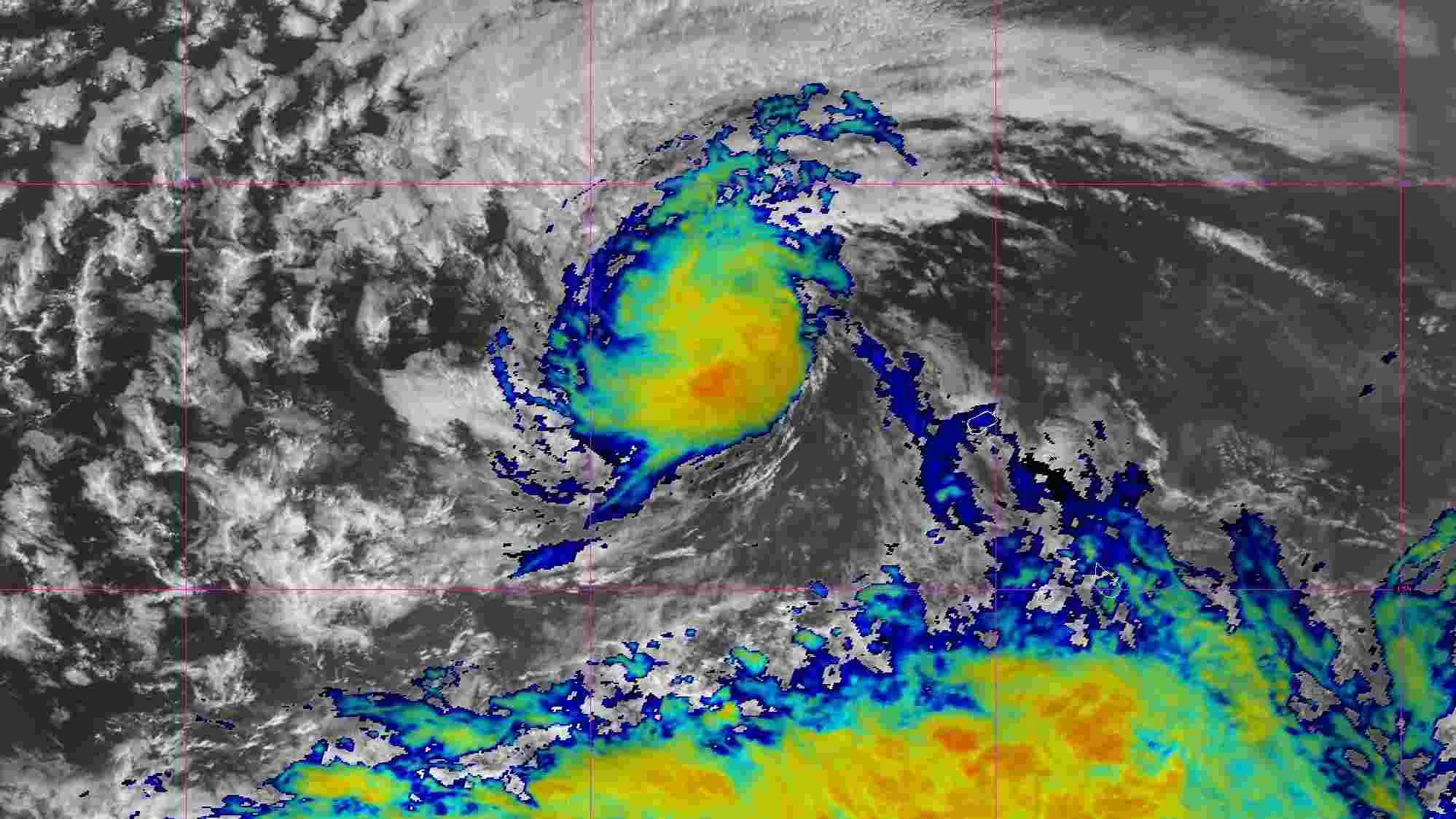
Live satellite imagery: https://t.co/6nstp15XaE pic.twitter.com/wMlcBJfb3t
What is Tropical Storm Erin 2025?
Tropical Storm Erin is an identified system in the Atlantic and continues to intensify and deepen. This system was developed on August 11, 2025, during the peak of the hurricane season in the Atlantic. It matured from a tropical wave located west of the Cabo Verde Islands and quickly became a named storm when ocean temperatures and environmental conditions exceeded 80°F.
As of publication, Erin has sustained winds of around 45 mph and is moving west at about 20 mph. It is currently just offshore and shows no imminent threat to land. However, indications are it may develop into the first named hurricane of the 2025 season in the next few days.
Unfortunately, Erin caused deadly flooding in Cape Verde before being classified, with six reported fatalities. Meteorologists are watching for any changes in direction or strength.
How Tropical Storm Erin Formed?
The tropical storm Erin was formed in the Eastern Atlantic on August 11, 2025, which originated from a tropical wave, moved away from the west coast of Africa. The system tracked the West with warm ocean water and favorable wind patterns, which allowed it to integrate and intensify into a designated storm.
Before the system was classified as a tropical storm, it caused heavy rainfall and dangerous effects in the Cape Verde Islands, causing flash flooding and six ambulances, including four children.
Current Status and Forecast
According to the latest advisories, Tropical Storm Erin is speeding westward across the Atlantic Ocean with maximum sustained winds near 45 mph and a forward motion of nearly 20 mph. The storm developed on August 11, 2025, and it appears to be gradually intensifying over warm ocean waters and low shear, both favorable conditions for further development.
The forecast models are indicating Erin may be able to develop into a hurricane in the next few days, and has the potential to be the first hurricane in the 2025 Atlantic season. At the current time, it seems the storm will stay away from land, but it is too early to be sure of its long-term path.
Meteorologists continue to watch the system closely, as it is possible that the steering winds could change, forcing the storm onto land. No land area has any active warnings at this time; however, residents in the Caribbean and southeastern U.S. should continue to monitor the forecast updates.


-1754995214033.jpg)
-1755004219454.jpg)

Comments
All Comments (0)
Join the conversation