Show Key Points
The weather landscape across the United States is reaching critical levels today, March 20, 2026, as an anomalous heat dome anchors itself over the Southwest. According to the National Weather Service (NWS), temperatures in Phoenix and parts of California are soaring 20 to 30 degrees above seasonal norms, potentially eclipsing all-time March records.
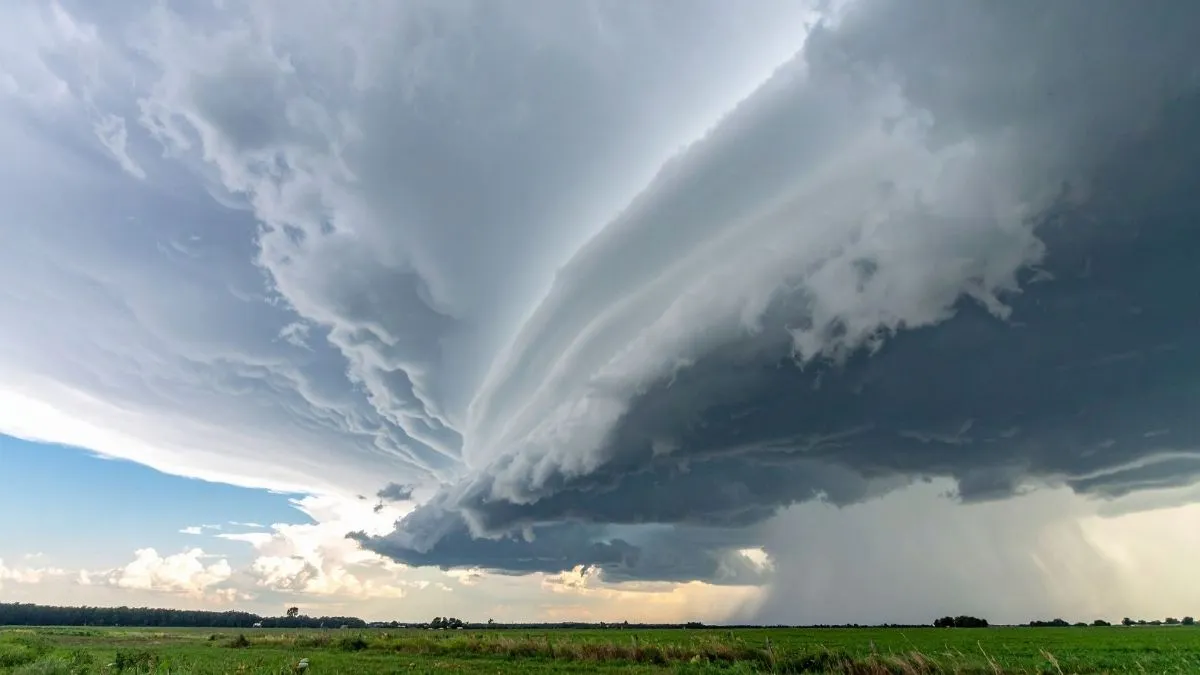
While the West swelters under extreme heat, a fast-moving clipper system is simultaneously triggering severe thunderstorms and snowfall across the Ohio Valley and interior New England.
NOAA meteorologists warn that this highly amplified atmospheric pattern is creating a triple-threat scenario, combining record warmth, critical fire conditions, and localized flooding from an active atmospheric river in the Northwest.
Will the Southwest Heatwave Break All-Time March Records?
A massive mid-level ridge is currently dominating the Western U.S., resulting in what experts call a virtually impossible event without climate-driven shifts. The HeatRisk tool indicates widespread Major impacts for Arizona and Southern California.
-
Phoenix, AZ: Forecasted highs of 104°F-106°F; the previous March record was 100°F.
-
California: Death Valley and desert regions are approaching 110°F.
-
Public Health: Authorities have issued Heat Advisories, urging residents to limit outdoor activity as overnight cooling remains minimal.
| Region | Forecasted High | Typical Average |
| Phoenix, AZ | 106°F | 77°F |
| Las Vegas, NV | 94°F | 71°F |
| Palm Springs, CA | 102°F | 81°F |
What Severe Storms and Snow are Impacting the East?
As the heat bubble expands into the Southern Plains, its periphery is clashing with cooler air to the North. This interaction is fueling a clipper system that is bringing a mix of wintry and volatile weather to the Eastern Seaboard.
-
Severe Thunderstorms: A marginal risk of damaging winds and isolated tornadoes exists for the Ohio Valley and Mid-Atlantic.
-
Interior Snowfall: Upstate New York and New England are seeing a quick burst of 2–5 inches of snow as the low-pressure system exits.
-
Flood Alerts: In the Pacific Northwest, an Atmospheric River is stalling over Washington, with NOAA predicting an additional 5 inches of rain, raising the risk of rain-on-snow flooding in higher elevations.
Early season #HeatDome persists over the western U.S., expanding east this weekend. Scores of daily record high temperatures are expected through next week with some additional monthly records for March through this weekend. Here are the updated Key Messages for this #HeatWave pic.twitter.com/pLy0USmbvS
— NWS Weather Prediction Center (@NWSWPC) March 19, 2026
Check Out - New Moon March 2026: Official Eid al-Fitr Sighting Dates for USA, Saudi Arabia, and UK
Are Fire Weather Warnings in Effect for the Plains?
The combination of record-breaking warmth and low relative humidity has triggered Red Flag Warnings across the Northern Rockies and Central Plains. The Storm Prediction Center (SPC) has outlined a Critical Risk of fire weather for parts of Wyoming, Nebraska, and South Dakota. Gusty winds reaching 40 mph could lead to rapid fire spread in areas where vegetation has already dried out due to the early spring thaw.
As this historic March weather event goes on, things are still changing. People in the Southwest, where it's hot, and the East, where storms are common, need to check local NWS updates often.


-1774010299423_t.webp)


Comments
All Comments (0)
Join the conversation