A tornado watch has been issued for the Kansas City metropolitan area until early Saturday morning as strong thunderstorms move across the region.
The National Weather Service issued a tornado watch for the Kansas City metro area on March 6, 2026, lasting until 4 a.m. Saturday, March 7. It covers Jackson, Clay, Platte counties in Missouri and Johnson, Wyandotte in Kansas, affecting 2.5 million people.
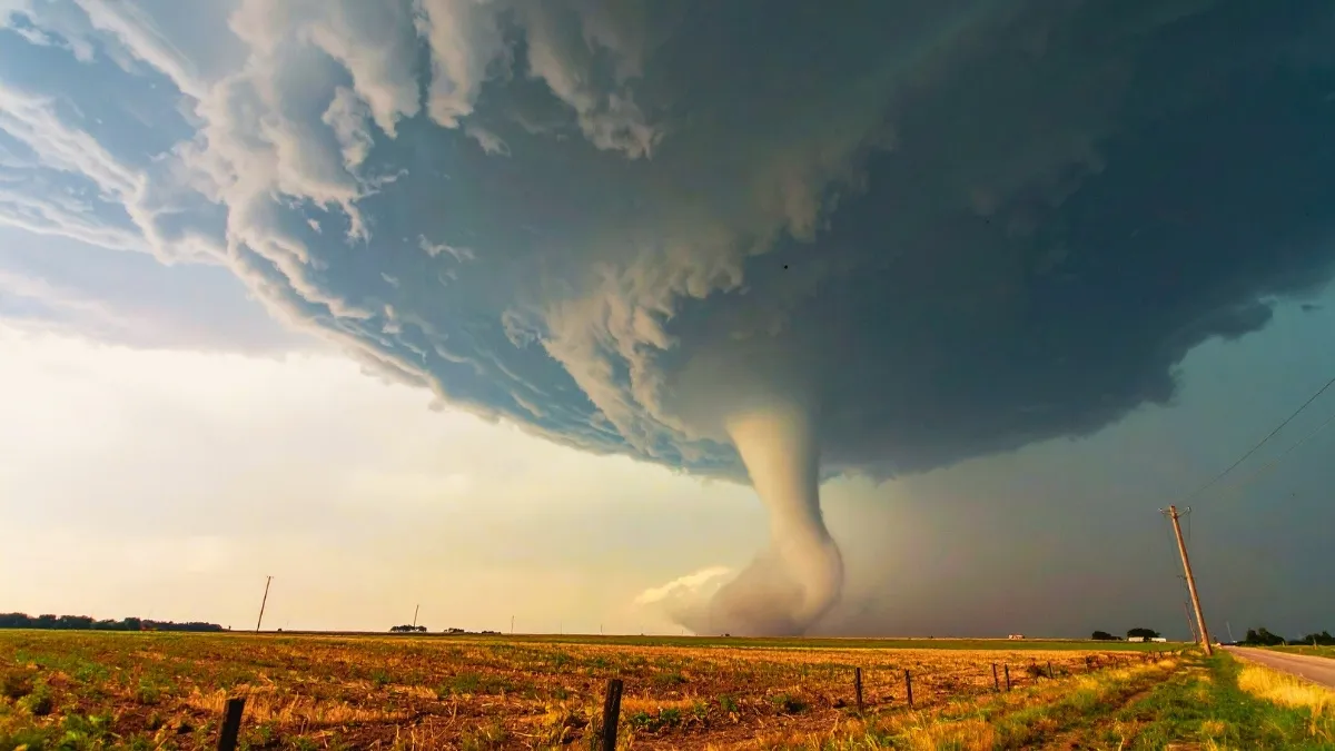
The tornado watch warned that conditions are favorable for powerful storms with supercell 2-inch hail, 80 mph winds, and possible EF2+ tornadoes.
Meteorologists say warm, humid air combined with an approaching storm system could trigger severe weather overnight.
Residents are advised to stay alert, monitor weather updates, and be ready to seek shelter if siren warnings are issued.
Tornado Warning including Kansas City MO, Overland Park KS and Kansas City KS until 12:00 AM CST pic.twitter.com/nv8GtwpL1d
— NWS Kansas City (@NWSKansasCity) March 7, 2026
Tornado Watch Issued for Kansas City Area till Early Saturday Morning
A tornado watch issued for the Kansas City area means weather conditions are favorable for tornadoes and severe thunderstorms overnight.
Storms fired after 8 p.m. on Friday, expanding from Topeka to St. Joseph. NWS notes high shear and CAPE fuel twisters.
Forecasters warned that the strongest storms could develop late Friday night into early Saturday morning. Some storms may produce wind gusts exceeding 60 mph and hail large enough to cause damage.
Check about Tornado Alley here.
What's a Tornado Watch?
A tornado watch means tornadoes are possible in the affected area, but they have not yet been confirmed. The alert is issued when atmospheric conditions are favorable for severe thunderstorms capable of producing tornadoes.
This is different from a tornado warning, which means a tornado has been detected by radar or spotted on the ground. The tornado watches cover broad areas like metro counties; whereas warnings narrow to paths.
During a watch, people should stay alert and monitor weather updates. Experts recommend preparing ahead by identifying safe shelter areas such as basements or interior rooms away from windows, stock water, flashlights and charge phones for NOAA radio updates.
Kansas City Severe Weather Safety Tips
Weather experts say the storms could move quickly across the metro area overnight. Because severe weather can develop suddenly, residents are encouraged to follow local forecasts and emergency alerts closely.
-
Monitor the official Kansas City government and weather website for accurate weather forecasts.
-
Avoid travel near Salina, Manhattan, hail risks smash cars.
-
When sirens are triggered, they communicate confirmed threats which means to take shelter and head low.
-
Keep your pets and farm animals indoors. Secure patio furniture or outdoors items as 80 mph blasts are expected.
Also know about Snowfall Forecast March 6: Colorado Mountains Brace for Up to 14 Inches.
The tornado watch issued for the Kansas City area highlights the risk of severe weather overnight. While not every storm will produce a tornado, conditions remain favorable for dangerous thunderstorms. Residents should remain alert, follow official weather updates, and be prepared to take shelter if warnings are issued.


Comments
All Comments (0)
Join the conversation