Show Key Points
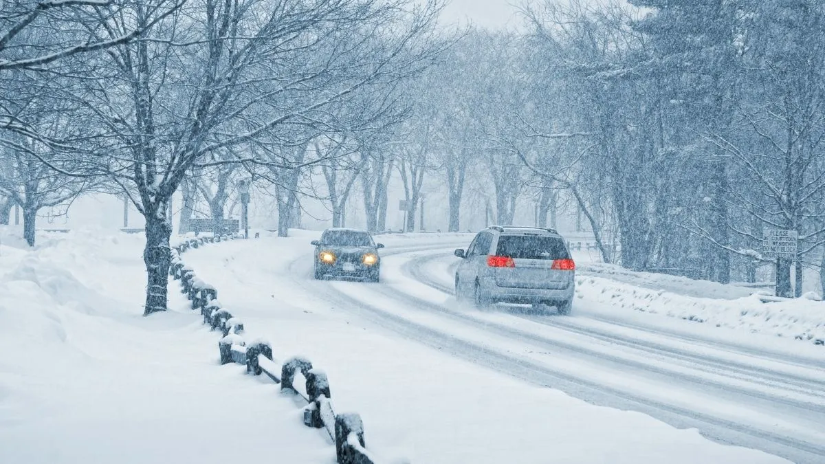
As meteorological spring begins today, Sunday, March 1, 2026, a potent winter storm is sweeping across the northern United States, ending any hopes of an early thaw. An Alberta Clipper system is currently fueling widespread snow from the Midwest through the Mid-Atlantic, drawing in a fresh surge of Arctic air from Canada.
The National Weather Service (NWS) has issued Winter Weather Advisories for a massive swath of the country, stretching from the Rockies to the New England coast.
Following the catastrophic Winter Storm Fern in January, this system is characterized by its rapid pace and a dangerously cold wake, with officials warning that even light accumulation will create hazardous flash-freeze conditions on major interstate corridors by Monday morning.
What is the Snow Timeline for Sunday and Monday?
The timing of this system is critical for travelers and commuters. The storm is tracking along the southern edge of a displaced Polar Vortex, which has dipped into the U.S. interior this weekend.
-
Midwest (Sunday Morning - Evening): Cities like Chicago and Detroit are seeing heavy snowfall early Sunday, with the bulk of the accumulation expected before sunset.
-
Northeast and Mid-Atlantic (Sunday Night - Monday): The system shifts toward New York City and Boston late Sunday. While coastal areas may see a wintry mix, interior regions will experience pure snow through the overnight hours.
-
The Flash Freeze Threat: As precipitation ends early Monday, temperatures are forecast to plummet into the teens, turning slushy roads into sheets of ice just in time for the work week.
| Region | Peak Snow Timing | Estimated Accumulation |
| Upper Midwest (MN, WI) | Sunday Morning | 3" – 6" |
| Great Lakes (MI, OH) | Sunday Afternoon | 2" – 5" |
| Northeast (NY, MA) | Sunday Night | 1" – 4" |
Will Snow Impact your Monday morning commute?
According to the latest National Weather Service briefings, the primary concern is the impact of the following Arctic air on wet surfaces. In states like Michigan and Illinois, a light ice event is expected to catch drivers off guard.
-
Reduced Visibility: Blowing snow will reduce sightlines to less than a half-mile in open areas of the Plains and Great Lakes.
-
Icy Overpasses: Because ground temperatures were recently near 50°F, the first layer of snow may melt and then rapidly refreeze on bridges and elevated surfaces.
-
Transit Delays: Major hubs, including O'Hare and Logan International, are already reporting potential ground stops as de-icing crews prepare for the Sunday night surge.
⛈️❄️A cold front is forecast to bring showers & thunderstorms to much of the Southeast to end the work week. Meanwhile, beginning this weekend, a frontal system will bring snow to portions of the Northern Plains & Intermountain West. For more info visit https://t.co/xmHl14IlGP pic.twitter.com/EgrzxA1L3I
— NWS Weather Prediction Center (@NWSWPC) February 26, 2026
How much Snow will Michigan and New England see?
In Michigan, the timeline suggests a transition from light flurries to steady heavy snowfall by Sunday afternoon. Official reports from NWS Detroit indicate a swath of 2 to 5 inches is possible along the I-94 corridor.
Meanwhile, Boston and interior Massachusetts are bracing for a coating of 2 inches, which, while modest, will be accompanied by wind chill values dipping near zero by Monday morning.
This one-two punch of moisture and extreme cold is a hallmark of the 2026 La Niña winter season, which experts predict will continue to deliver late-season surprises well into late March.
Check Out - 3.5 Magnitude Earthquake Strikes Off Rancho Palos Verdes Coast; Southern California Shaken
While this Sunday's snow event may not reach the record-breaking totals of January’s Snowmageddon, its timing makes it a significant threat to regional mobility. Residents are urged to monitor real-time radar and heed National Weather Service travel alerts. The transition to a deep freeze by Monday ensures that winter’s grip remains firm across the northern half of the country.


-1772266975969_t.webp)
Comments
All Comments (0)
Join the conversation