

Lowest point in the US: Ever stood on a beach and wondered how far down the land truly stretches? Or perhaps think of the deepest dip in the entire country? While headlines often celebrate towering peaks, the unsung heroes of our geography are the lowest points. They are interested in natural depressions that show surprising things about the different landscapes in the United States. These points give you a unique way to see the amazing geological story of the United States. For example, Death Valley in California is famous for its extreme temperatures, and the oceans are huge. So, let's show the names and find out what the lowest point in the US is, as well as the deepest point in each state.
Which is the Lowest Elevation in the US?
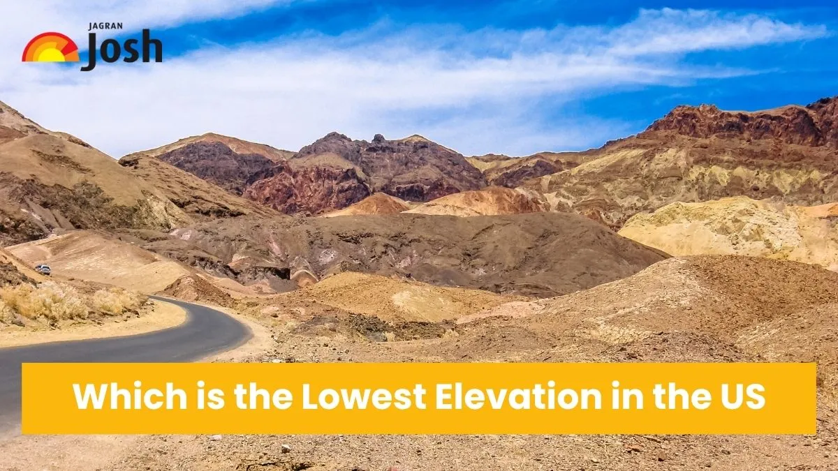
Badwater Basin in Death Valley, California, is the lowest point in the United States. It is an amazing 282 feet (86 meters) below sea level. This famous spot, which is in Death Valley National Park, is not only the lowest point in North America, but also one of the hottest and driest places on Earth. Its stark, salt-covered landscape is a testament to extreme geological forces, drawing curious visitors from around the globe to witness its profound depth.

Death Valley
Check Out: Which is the Largest Forest in the United States? Check List by State and Size
List of Lowest Points in Each US State
Here are the lowest geographical points across all 50 U.S. states that range from sea level coastal areas to riverbeds and unique desert
| S.No. | US State | Lowest Point | Elevation (feet) | Location |
| 1 | Alabama | Gulf of Mexico | 0 | Sea level |
| 2 | Pacific Ocean | 0 | Sea level | |
| 3 | Colorado River | 70 | Yuma County | |
| 4 | Ouachita River | 55 | Ashley-Union County | |
| 5 | Death Valley (Badwater Basin) | -282 | Inyo County | |
| 6 | Colorado | Arikaree River | 3,317 | Yuma County |
| 7 | Long Island Sound | 0 | Sea level | |
| 8 | Atlantic Ocean | 0 | Sea level | |
| 9 | Atlantic Ocean | 0 | Sea level | |
| 10 | Atlantic Ocean | 0 | Sea level | |
| 11 | Hawaii | Pacific Ocean | 0 | Sea level |
| 12 | Snake River | 710 | Nez Perce County | |
| 13 | Mississippi River | 279 | Alexander County | |
| 14 | Ohio River | 320 | Posey County | |
| 15 | Mississippi River | 480 | Lee County | |
| 16 | Kansas | Verdigris River | 679 | Montgomery County |
| 17 | Mississippi River | 257 | Fulton County | |
| 18 | New Orleans | -8 | Orleans Parish | |
| 19 | Atlantic Ocean | 0 | Sea level | |
| 20 | Atlantic Ocean | 0 | Sea level | |
| 21 | Massachusetts | Atlantic Ocean | 0 | Sea level |
| 22 | Lake Erie | 571 | ||
| 23 | Lake Superior | 601 | ||
| 24 | Gulf of Mexico | 0 | Sea level | |
| 25 | Saint Francis River | 230 | Dunklin County | |
| 26 | Montana | Kootenai River | 1,800 | Lincoln County |
| 27 | Missouri River | 840 | Richardson County | |
| 28 | Colorado River | 479 | Clark County | |
| 29 | New Hampshire | Atlantic Ocean | 0 | Sea level |
| 30 | Atlantic Ocean | 0 | Sea level | |
| 31 | New Mexico | Red Bluff Reservoir | 2,842 | Eddy County |
| 32 | Atlantic Ocean | 0 | Sea level | |
| 33 | Atlantic Ocean | 0 | Sea level | |
| 34 | Red River | 750 | Pembina County | |
| 35 | Ohio River | 455 | Hamilton County | |
| 36 | Oklahoma | Little River | 289 | McCurtain County |
| 37 | Pacific Ocean | 0 | Sea level | |
| 38 | Delaware River | 0 | Sea level | |
| 39 | Atlantic Ocean | 0 | Sea level | |
| 40 | Atlantic Ocean | 0 | Sea level | |
| 41 | South Dakota | Big Stone Lake | 966 | Roberts County |
| 42 | Mississippi River | 178 | Shelby County | |
| 43 | Gulf of Mexico | 0 | Sea level | |
| 44 | Beaver Dam Wash | 2,000 | Washington County | |
| 45 | Lake Champlain | 95 | ||
| 46 | Virginia | Atlantic Ocean | 0 | Sea level |
| 47 | Pacific Ocean | 0 | Sea level | |
| 48 | Potomac River | 240 | Jefferson County | |
| 49 | Lake Michigan | 579 | ||
| 50 | Belle Fourche River | 3,099 | Crook County |
Check Out: List of 9 Most Incredible Animals in South America You Need to Discover
These diverse low points highlight the incredible geographical variety of the United States, from the deep desert basin of Death Valley to the vast expanses of the Atlantic and Pacific Oceans. Every lowest point tells a different story about a state's natural history and how it has interacted with water, which has shaped the land we live on.


Comments
All Comments (0)
Join the conversation